Первый пример сочетания GPS и AIS подделок
Одним из первых примеров сочетания GPS и AIS подделок является захват иранцами танкера под флагом Великобритании. Проходя через пролив Хормуз в международных водах в июле 2019 года, он внезапно пошел на север и вошел в иранские территориальные воды, где был немедленно захвачен патрульными лодками иранского флота. Скорее всего, это произошло в ответ на захват британскими властями иранского судна в начале года из-за подозрений в нарушении санкций Европейского союза.
Эпизоды подделок продолжились и превратились в более мощные проявления дестабилизации
В июле 2019 года американский судно M/V сообщало о серии ложных данных GPS и AIS в порту Шанхая. В отличие от предыдущих ситуаций подделки, когда судно считало, что оно находится в неправильном месте, в этот раз целевые суда казались прыгающими. Дальнейший анализ многих событий показал, что ложные местоположения образовывают кольца. Так называемые круги на полях были обнаружены в других местах, включая Тегеран. Во всех случаях суда находились вблизи места подделки. Позднее анализ показал, что круговая подделка происходила в районе Пойнт-Рейес (неподалеку от Сан-Франциско), где подделанные суда находились на расстоянии до 10 000 миль от места события.
Эскалация инцидентов с круговыми подделками
Порт Шанхая и последующие инциденты с круговыми подделками перешли к стадии, когда суда могут находиться в любом месте на Земле относительно места подделываемого местоположения. Китай является одним из основных подозреваемых в этих инцидентах кольцевых подделок. Их давно подозревали в подделках AIS для скрытия своих рыболовных флотов, занимающихся незаконным, нерегулируемым или неуведомленным рыболовством, показывая их на расстоянии сотен или тысяч миль от их фактических местоположений.
Цели подделок и опасные последствия
Эти эпизоды подделок AIS совершаются по многим целям, включая демонстрацию возможностей; скрывание незаконного, нерегулируемого или несообщенного рыболовства, контрабанды и других незаконных действий; и сокрытие личности для избежания обнаружения, санкций или проверок. Масштабная подделка боевых кораблей представляет собой еще более опасный уровень эскалации, обостренный тем, что боевые корабли не всегда регулярно транслируют информацию AIS. Например, данные AIS показали, что HMS и пять сопровождающих кораблей направлялись к Ирландскому морю в сентябре 2020 года, в то время как одновременные спутниковые снимки показали пустой океан в их предполагаемом местоположении. Фактически шесть судов не были там, где их трек AIS указывал, и возможно, вообще не транслировали AIS сообщения.
Автор: SEO копирайтер
Лжепозиция AIS судов НАТО в Черном море: В июне 2021 года лжепозиция судов Североатлантического договора (НАТО) в Черном море вызвала значительные опасения, особенно в контексте последующих событий в данной области. Инцидент включал два военных корабля НАТО, HMS (Великобритания) и HNLMS (Нидерланды), прибывших в Одессу (Украина) 18 июня после полудня.
Значение морской домены для национальной безопасности США
Стратеги с давних пор осознавали, что морское превосходство и контроль над морскими активами играют ключевую роль в установлении глобального влияния. Альфред Тейер Мэн отмечал, что хотя флоты имеют существенное значение для обеспечения мировой торговли и связи, небольшая морская сила может превзойти гораздо более крупную, сосредотачивая усилия на ключевых уязвимостях противника. Следовательно, когда морские активы страны подвергаются нападению, это может иметь далеко идущие геополитические, военные и экономические последствия. Потопление USS (1898) и RMS (1915), а также нападения на USS и USS (1964), стали предпосылками крупных конфликтов и продолжительных военных кампаний. Несмотря на то, что ВМС США остается крупнейшей и наиболее экспедиционной силой в мире, более мелкие силы, злонамеренные державы и нерегулярные противники нарушают морские перевозки и морские активы, используя новые и инновационные методики. Эти методики часто включают в себя подход система систем, при котором злонамеренные действующие лица сталкиваются с противниками через критические компоненты операционных систем.
Угрозы морской безопасности и превосходства
Глобальная система позиционирования GPS (Global Positioning System)
GPS предоставляет важную информацию о позиции и времени, необходимые для навигации судов и обеспечения безопасности на море. Однако уязвимости в этой технологии могут привести к серьезным нарушениям в области морской безопасности и превосходства.
Автоматическая система идентификации AIS (Automatic Identification System)
AIS представляет собой ключевой элемент для отслеживания судов и обмена информацией между ними. Уязвимости в этой системе могут привести к недостаточной ситуационной осведомленности и повышению риска инцидентов на море.
Значение морской транспортной системы для экономики США
Морская транспортная система несправедливо часто недооценивается в своей критической значимости для национальной безопасности США. Девяносто процентов импорта и экспорта США осуществляется морским путем, а морская транспортная система (МТС) приносит $5,4 триллиона национальной экономике, что составляет около 25 процентов ВВП США. МТС – это обширная сеть судоходных каналов, портов, шлюзов, морских терминалов, причалов и морских путей, облегчающая эту торговлю. Как МТС, но на глобальном уровне, глобальная морская транспортная сеть (GMTN) – это комплекс портов, водных путей, причалов и терминалов, который обеспечивает более 70 процентов стоимости мировой торговли и почти 90 процентов ее объема. Эти системы являются сложными и взаимозависимыми, и, подобно другим аспектам критической инфраструктуры, их составляющие части часто недооцениваются как неотъемлемые элементы глобальной экономики и стратегической безопасности. Не преувеличено утверждать, что МТС неотъемлемо связана с нашими продовольственными, энергетическими, финансовыми и национальными интересами, а также с проекцией военной мощи по всему миру.
Вакансия: SEO копирайтер и специалист по содержанию
Требуемый опыт работы:
- Создание проектных показателей бюджета
- Проверка финансово-экономических обоснований
Информация о вакансии:
- Местоположение: Москва
- График работы: Полный рабочий день
- Вакансия открыта: Да
- Оплата труда: По договоренности
- Связь: [email protected]
Другие вопросы? Вы можете связаться с нами для получения дополнительной информации.
Мы верим, что морская безопасность и экономика являются ключевыми компонентами глобальной стабильности. Через профессиональное SEO копирайтинговое содержание, мы стремимся повысить осведомленность о важности этих вопросов и привлечь внимание к необходимости их защиты и поддержки.
Морское превосходство и безопасность – это обязательные составляющие благополучного мира и процветания.
Неточность позиционирования и недоверие к информации
Мировая торговая система в значительной степени полагается на четыре основных глобальных навигационных спутниковых системы (ГНСС): Бэйдоу (Китай), Галилео (Европейский Союз), ГЛОНАСС (Россия) и GPS (США) — для навигации, маршрутизации и осведомленности о ситуации на море. ГНСС предоставляет услуги позиционирования, навигации и времени (ПНВ), которые используются не только для наземной, морской и воздушной навигации, но и для точного времени, необходимого для работы критической инфраструктуры. Важность времени не может быть преувеличена; если сигналы времени GPS выйдут из строя или будут сильно нарушены, это приведет к широкомасштабному отказу телекоммуникационных, финансовых услуг, транспорта и сетей распределения электроэнергии, чтобы перечислить лишь некоторые из них.
Уровень точности от GPS
GPS может предоставлять информацию о позиционировании с точностью до 3 футов от фактического местоположения приемника. Хотя такая точность может не быть необходима в открытом море (так называемые голубые воды), точное ПНВ является неотъемлемым в литоральных зонах (бурные воды) и при прохождении узких узлов и критических точек, таких как пролив Хормуз, пролив Малаккского, Панамский канал, Босфорский пролив и Суэцкий канал. GPS широко признан как лучшая ГНСС в мире с точки зрения точности, строгости и надежности и по этой причине является наиболее распространенной системой в мире. Однако у GPS есть три уязвимости: помехи, спуфинг и полная системная отказ.
Q&A
| Вопрос | Ответ |
|---|---|
| Что такое помехи GPS? | Они обозначают, что приемник не может обнаружить законный сигнал GPS из-за интерференции от близких радиопередач. |
| Что такое спуфинг GPS? | Это когда злоумышленник создает ложный сигнал, имитируя сигнал GPS, чтобы ввести приемник в заблуждение относительно своего фактического местоположения. |
| Чем GPS особенно уязвим? | Основные уязвимости GPS — помехи, спуфинг и полный системный отказ, которые могут привести к серьезным проблемам в работе критической инфраструктуры. |
GPS jamming is not a new phenomenon. While initially developed for the military, inexpensive GPS jammers have been available to the public—albeit illegal to use—for well over a decade. One of the earliest widely publicized examples of this activity involved a person fined in 2013 for using a GPS jammer in the proximity of Newark Liberty International Airport and interfering with flight operations. Rampant GPS jamming activities are taking place around the world, most notably at airports, with Norway being particularly affected. Moreover, China, North Korea, and Russia each have long histories of efforts to jam or otherwise neutralize the GNSS of other countries.
GPS causes a receiver to report its location at one place when it is in another place. In 2012, a team from the University of Texas at Austin first demonstrated spoofing to the Department of Homeland Security by spoofing GPS signals to a drone, causing it to lose awareness of its proper altitude. In June 2013, the same team was able to spoof the location of the White Rose of Drachs, an $80 million, 213-foot superyacht, causing it to change course in the middle of the Mediterranean Sea. GPS spoofing is not limited to laboratory conditions. The first large-scale public case of GPS spoofing in the MTS was in June 2017. M/V was anchored in the Black Sea off the Russian port of Novorossiysk, but its GPS reported its location as Gelendzhik Airport, 20 nautical miles away. The 37.5-ton tanker was not alone; the receivers on at least two dozen other vessels placed them in the same location.
The incident was neither an isolated event nor even the first such spoofing incident. In 2019, the Center for Advanced Defense Studies released a report describing nearly 9,900 incidents of GPS spoofing incidents in the Black Sea, Crimea, the Russian Federation, Syria, and other locations as far back as 2016, all linked to the Russian military. In 2020, investigative journalists reported that a German research vessel detected GPS spoofing and jamming events in many sites on its worldwide voyage in 2017 and 2018.
of the entire GPS system is, of course, the ultimate vulnerability. GPS employs a constellation of more than 32 satellites, 29 of which are in use at any one time—a minimum of 24 are required for the system to operate. By design, GPS is resilient to “natural” failures; if one satellite suffers a failure, it is moved out of position and a replacement takes over. Yet Russia and China have both demonstrated “satellite killer” capability, and, since the spring of 2021, Russian President Vladimir Putin has repeatedly threatened to shoot down many, or all, GPS satellites. GPS has no resiliency against such a systemic failure.
The vulnerabilities of and threats to GPS are not merely issues for the maritime community but affect all aspects of modern society. There is not a concentrated effort to supplement or augment GPS in the near term. While GPS is managed by the U.S. Space Force, it is both a military and a civilian asset, so something bigger than a military solution is required. The Russian invasion of Ukraine in February 2022 highlighted both the necessity of an assured PNT system and the requirement for augmentation.
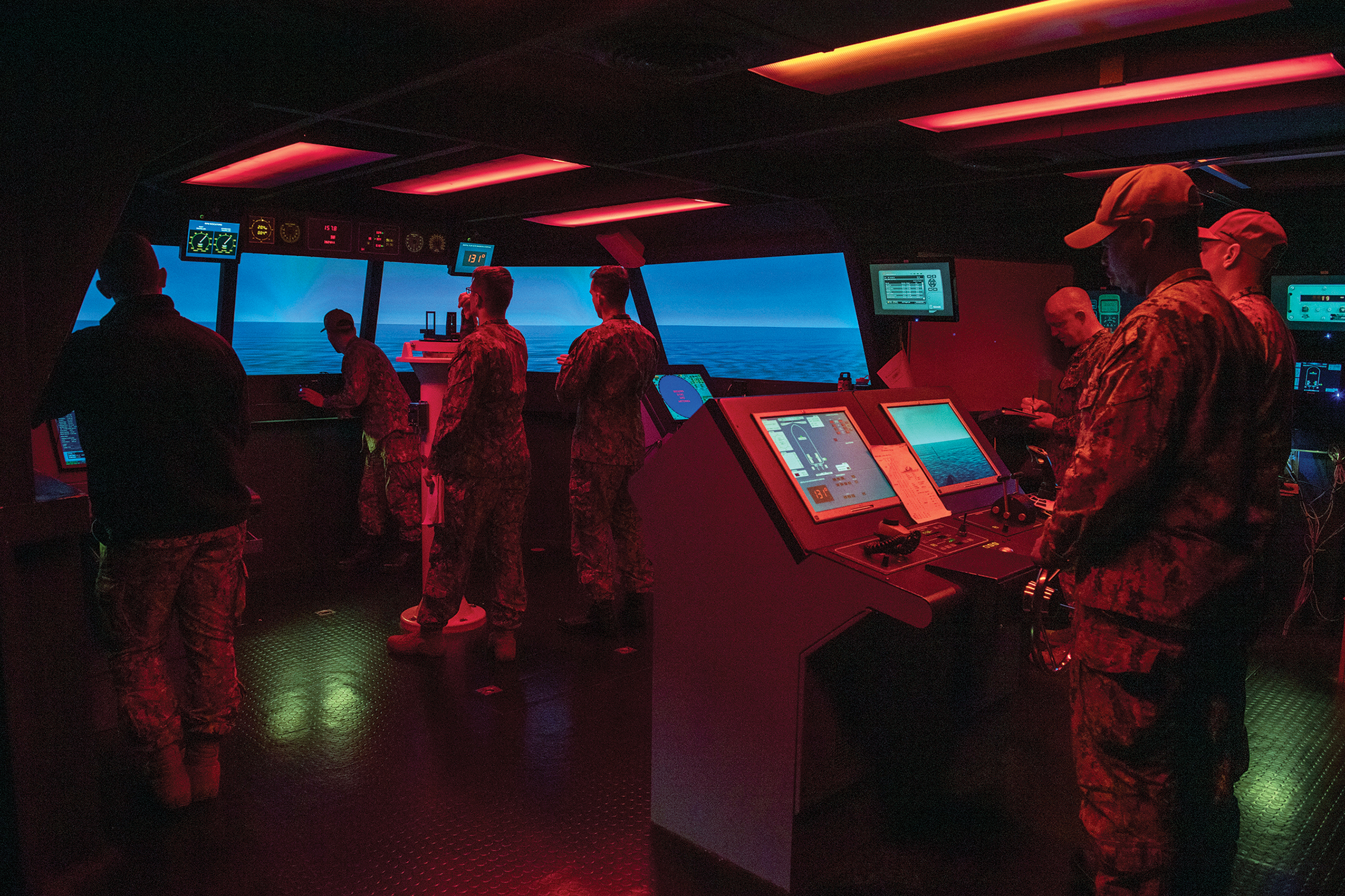
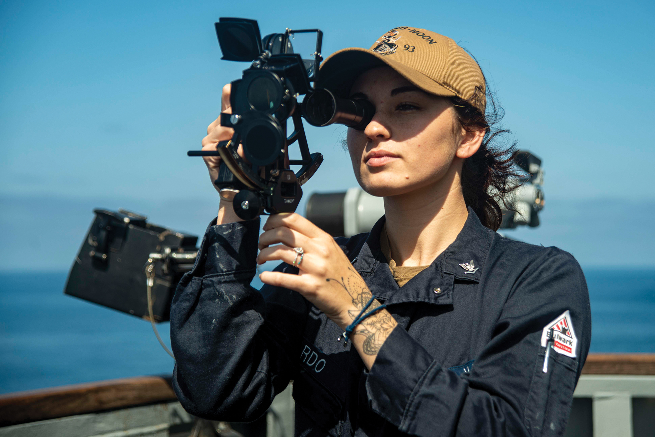
The jamming and spoofing of GPS and AIS information has escalated in the last half-dozen years from simple demonstrations of capability to truly dangerous situations where misperceptions could ignite a major conflict. The attack surface is becoming increasingly ubiquitous and strikes on military assets can be staged via nonmilitary vectors. The U.S. defense community can mitigate the vulnerabilities in its systems in several ways. First, training and awareness can make both military and commercial mariners aware of the frailties of the systems. Maritime operators and bridge officers should have knowledge of the information and operational technology systems aboard their ships and the myriad ways in which they are interconnected and how they interact. Information security–aware officers as well as shipboard detection systems should be integrated into maritime personnel and management systems. Navigation and bridge personnel must be able to determine when the information displayed by the automated systems is suspect and must have independent means of validating those systems. In addition, celestial navigation techniques and the science of inertial and hyperbolic systems need to be integrated into the curricula of maritime practitioners. Furthermore, maritime naval exercises need to include scenarios where GNSS and AIS have been disrupted by enemy forces and test how practitioners would respond without current technology. Exercises should also integrate opportunities that test the innovative capacity of cyber defenders as well as their ability to proactively target the enemy.
Alternatively, AIS security solutions are highly likely to yield positive gains to commercial industries. Competitive bids for AIS systems should integrate security measures, such as public-key or asymmetric cryptography, digital signatures, or a combination of the identity-based authentication that is commonplace in commercial applications, computers, and on mobile phones. Yet securing AIS might be an even harder problem to solve because it demands international agreement within two United Nations organizations—the International Maritime Organization is responsible for SOLAS and the International Telecommunication Union for the AIS over-the-air protocol. Mitigating this challenge will require a clear vision and proactive leadership.
Because of the grave danger that GPS and AIS weaponization entails, it is essential that policymakers and maritime operators understand not only the risks and implications of these threats, but also the mitigation techniques and countermeasures that add resilience to the warfighter. Moreover, the U.S. Government needs to address the significant advantage that our adversaries have developed in PNT resilience and augmentation. The redundancies and security initiatives may be costly, yet both PNT resilience and augmentation and AIS security measures are vital for protecting our nation’s critical assets and mitigating a future conflict.
The authors gratefully acknowledge the support of the Naval War College and feedback from our fellow participants at the War College’s Cyber and Innovation Policy Institute 2022 Summer Workshop on Maritime Cyb
Sun Tzu, The Art of War (New York: Simon & Schuster, 2004).
Alfred T. Mahan, The Influence of Seapower Upon History, 1660–1783, 12 ed. (Boston: Little, Brown and Company, 2004), 12–16.
Jeffrey Engstrom, Systems Confrontation and System Destruction Warfare: How the Chinese People’s Liberation Army Seeks to Wage Modern Warfare (Santa Monica, CA: RAND, 2018), https://www.rand.org/pubs/research_reports/RR1708.html.
The term great systems conflict is attributed to Chris C. Demchak, “Achieving Systemic Resilience in a Great Systems Conflict Era: Coalescing Against Cyber, Pandemic, and Adversary Threats,” The Cyber Defense Review 6, no. 2 (Spring 2021), https://cyberdefensereview.army.mil/Portals/6/Documents/2021_spring_cdr/05_Demchak-CDR_V6N2_Spring_2021.pdf?ver=fpA19JdBy-n6fRbxSh8paA%3D%3D.
Cyber Strategic Outlook: The United States Coast Guard’s Vision to Protect and Operate in Cyberspace (Washington, DC: U.S. Coast Guard, August 2021), https://www.uscg.mil/Portals/0/Images/cyber/2021-Cyber-Strategic-Outlook.pdf.
David Alderson, Daniel Funk, and Ralucca Gera, “Analysis of the Global Maritime Transportation System as a Layered Network,” Journal of Transportation Security, November 28, 2019, 1–35, https://calhoun.nps.edu/handle/10945/25530; Jason Ileto, “Cyber at Sea: Protecting Strategic Sealift in the Age of Strategic Competition,” Modern War Institute, May 10, 2022, https://mwi.usma.edu/cyber-at-sea-protecting-strategic-sealift-in-the-age-of-strategic-competition/; Gary C. Kessler and Steven D. Shepard, Maritime Cybersecurity: A Guide for Leaders and Managers, 2 ed. (Kindle Direct Publishing, September 2022), https://www.maritimecybersecuritybook.com/.
Pratap Misra and Per Enge, Global Positioning System: Signals, Measurements, and Performance, rev. 2 ed. (Lincoln, MA: Ganga-Jamuna Press, 2021).
Gary C. Kessler and Diane M. Zorri, Cross Domain IW Threats to SOF Maritime Missions: Implications for U.S. SOF (MacDill Air Force Base, FL: Joint Special Operations University Press, 2021), https://commons.erau.edu/cgi/viewcontent.cgi?article=2765&context=publication.
Bill Bostock, “Downed Russian Fighter Jets Are Being Found With Basic GPS ‘Taped to the Dashboards,’ UK Defense Minister Says,” , May 10, 2022, https://www.businessinsider.com/russia-su34-jets-basic-gps-receivers-taped-to-dashboards-uk-2022-5.
Tom Nardi, “Teardown: Mini GPS Jammer,” , September 8, 2020, https://hackaday.com /2020/09/08/teardown-mini-gps-jammer/.
Tegg Westbrook, “The Global Positioning System and Military Jamming: The Geographies of Electronic Warfare,” Journal of Strategic Security 12, no. 2 (2019), 1–16, https://digitalcommons.usf.edu/cgi/viewcontent.cgi?article=1720&context=jss.
Mark L. Psiaki, Todd E. Humphreys, and Brian A. Stauffer, “Attackers Can Spoof Navigation Signals Without Our Knowledge. Here’s How to Fight Back GPS Lies,” 53, no. 8 (August 2016), 26–53.
Dana Goward, “Mass GPS Spoofing Attack in Black Sea?” The Maritime Executive, July 11, 2017, https://maritime-executive.com/editorials/mass-gps-spoofing-attack-in-black-sea.
Westbrook, “The Global Positioning System and Military Jamming.”
“Above Us Only Stars: Exposing GPS Spoofing in Russia and Syria,” Center for Advanced Defense Studies (C4ADS), March 26, 2019, https://c4ads.org/reports/above-us-only-stars/.
Katherine Dunn, “The Long Ocean Voyage That Helped Find the Flaws in GPS,” , January 24, 2020, https://fortune.com/2020/01/24/gps-disruption-test-voyage/.
Dana A. Goward and John Garamendi, “Putin Is Holding GPS Hostage. Here’s How to Get It Back,” , April 12, 2022, https://www.defensenews.com/opinion/2022/04/12/putin-is-holding-gps-hostage-heres-how-to-get-it-back/.
Dana A. Goward, “Get the Bullseye Off GPS,” , April 19, 2022, https://spacenews.com/op-ed-get-the-bullseye-off-gps/.
Kessler and Shepard,
Michelle W. Bockmann, “Seized UK Tanker Likely ‘Spoofed’ by Iran,” , August 16, 2019, https://lloydslist.maritimeintelligence.informa.com/LL1128820/Seized-UK-tanker-likely-spoofed-by-Iran.
Mark Harris, “Phantom Warships Are Courting Chaos in Conflict Zones,” , July 29, 2021, https://www.wired.com/story/fake-warships-ais-signals-russia-crimea/.
“Shanghai GPS Spoofing,” video, 0:42, C4ADS, 2019, for download, https://drive.google.com/file/d/1dTWu7H9JjRyN0uQPZ9HwiUzCFd7cd5pL/view.
Bjorn Bergman, “AIS Ship Tracking Data Shows False Vessel Tracks Circling Above Point Reyes, Near San Francisco,” , May 26, 2020, https://skytruth.org/2020/05/ais-ship-tracking-data-shows-false-vessel-tracks-circling-above-point-reyes-near-san-francisco/.
James R. Watson and A. John Woodill, “Anticipating Illegal Maritime Activities From Anomalous Multiscale Fleet Behaviors,” , October 15, 2019, https://arxiv.org/pdf/1910.05424.pdf.
Harris, “Phantom Warships Are Courting Chaos in Conflict Zones.”
H.I. Sutton, “Positions of Two NATO Ships Were Falsified Near Russian Black Sea Naval Base,” , June 21, 2021, https://news.usni.org/2021/06/21/positions-of-two-nato-ships-were-falsified-near-russian-black-sea-naval-base.
Gary C. Kessler, “AIS Spoof of a Warship,” video, 2:13, August 22, 2021, https://www.garykessler.net/gck/202108_MOSKVA_spoof.mp4. The sunk in the Black Sea during the Russian invasion of Ukraine in April 2022. The DEFCON hacker convention regularly hosts mini-conferences titled “Hack the Sea” or “Hack the Village,” where participants in the information and security community are invited to partake in experiential learning on how to protect cyber assets.
Robert J. Hanyok, “Skunks, Bogies, Silent Hounds, and the Flying Fish: The Gulf of Tonkin Mystery, 2–4 August 1964,” 19/20 (Winter 2000/Spring 2001), 4–10, https://nsarchive2.gwu.edu/NSAEBB/NSAEBB132/relea00012.pdf.
Dale Andradé and Kenneth Conboy, “The Secret Side of the Tonkin Gulf Incident,” Naval History Magazine 13, no. 4 (August 1999), https://www.usni.org/magazines/naval-history-magazine/1999/august/secret-side-tonkin-gulf-incident.
Hanyok, “Skunks, Bogies, Silent Hounds, and the Flying Fish.”
Cassia Sari, “Cyberattacks Can Invoke NATO Defence Clause,” The Organization for World Peace, April 25, 2022, https://theowp.org/cyberattacks-can-invoke-nato-defence-clause/.
Donn B. Parker, “Toward a New Framework for Information Security?” in Computer Security Handbook, 6 ed., ed. Seymour Bosworth, Michel E. Kabay, and Eric Whyne (Hoboken, NJ: John Wiley & Sons, Inc., 2015).
Michael Klipstein and Tinatin Japaridze, “Collective Cyber Defence and Attack: NATO’s Article 5 After the Ukraine Conflict,” European Leadership Network, May 16, 2022, https://www.europeanleadershipnetwork.org/commentary/collective-cyber-defence-and-attack-natos-article-5-after-the-ukraine-conflict/.
Jake Thomas, “‘They’re Jamming Everything’: Putin’s Electronic Warfare Turns Tide of War,” , June 3, 2022, https://www.newsweek.com/theyre-jamming-everything-putins-electronic-warfare-turns-tide-war-1712784.
Chapuis, “En guerre en Ukraine, la Russie brouille la navigation par satellites et utilise le système Loran.”
Terminations, Reductions, and Savings: Budget of the U.S. Government, Fiscal Year 2010 (Washington, DC: Office of Management and Budget, 2009), https://www.govinfo.gov/content/pkg/BUDGET-2010-TRS/pdf/BUDGET-2010-TRS.pdf.
Frank Liobondo Coast Guard Authorization Act of 2018, Public Law 115-282, 115 Cong., 2 sess., December 4, 2018, https://www.congress.gov/115/plaws/publ282/PLAW-115publ282.pdf.
Aaron Martin, “Senate Bill Would Require Establishment of Land-Based Alterative to GPS Satellite Timing Signals,” Homeland Preparedness News, December 19, 2017, https://homelandprepnews.com/stories/25836-senate-bill-require-establishment-land-based-alternative-gps-satellite-timing-signals/; Athanasios K. Goudosis and Sokratis K. Katsikas, “Secure AIS with Identity-Based Authentication and Encryption,” 14, no. 2 (June 2020), 287–298, http://dx.doi.org/10.12716/1001.14.02.03; Gary C. Kessler, “Protected AIS: A Demonstration of Capability Scheme to Provide Authentication and Message Integrity,” 14no. 2 (June 2020), 279–286, http://dx.doi.org/10.12716/1001.14.02.02; “PNT ExCom Backs eLoran as a Step to Full GPS Backup System,” , December 10, 2015, https://insidegnss.com/pnt-excom-backs-eloran-as-a-step-to-full-gps-backup-system/.
Kessler and Zorri, “Cross Domain IW Threats to SOF Maritime Missions.”
Baorong Yan et al., “High-Accuracy Positioning Based on Pseudo-Ranges: Integrated Difference and Performance Analysis of the Loran System,” 20, no. 16 (August 2020), 4436, https://doi.org/10.3390/s20164436; Dana Goward, “China Expanding Loran as GNSS Backup,” , October 12, 2020, https://www.gpsworld.com/china-expanding-loran-as-gnss-backup/; Wenhe Yan et al., “An eLoran Signal Cycle Identification Method Based on Joint Time–Frequency Domain,” 14, no. 2 (January 2022), 250, https://doi.org/10.3390/rs14020250.
Michael J. Biercuk and Richard Fontaine, “The Leap Into Quantum Technology: A Primer for National Security Professionals,” War on the Rocks, November 17, 2017, https://warontherocks.com/2017/11/leap-quantum-technology-primer-national-security-professionals/.
Dana Goward, “China Leads World With Plan for ‘Comprehensive’ PNT,” , November 14, 2019, https://www.gpsworld.com/china-leads-world-with-plan-for-comprehensive-pnt; David H. Millner, Stephen Maksim, and Marissa Huhmann, “BeiDou: China’s GPS Challenger Takes Its Place on the World Stage,” Joint Force Quarterly 105 (2 Quarter 2022), 23–31, https://ndupress.ndu.edu/Media/News/News-Article-View/Article/2999161/beidou-chinas-gps-challenger-takes-its-place-on-the-world-stage/.
Garath Wimpenny et al., “Securing the Automatic Identification System (AIS): Using Public Key Cryptography to Prevent Spoofing Whilst Retaining Backwards Compatibility,” Journal of Navigation 75, no. 2 (2022), 333–345.
Geopolitical Risks and Implications
The 2021 Black Sea incident appears to be the pre-staging of history. The most likely source of the spoofing of NATO vessels is Russia, which was able to engage in saber-rattling rhetoric in the aftermath of the events. Although most of the world understood that the tracks were bogus, the Russian people likely believed the evidence of NATO aggression. From Putin’s standpoint, his domestic audience—not the rest of the world—is the only audience that needs to be convinced of anything.
It is uncertain whether the spoof of the NATO vessels was a test of capability or if it was intended as a pretext to war. If it was the latter, it would not be the first time that false electronic signals at sea have provided a rationale for armed conflict. Consider the object lesson of the Gulf of Tonkin incidents. On August 2, 1964, the USS came under attack by three North Vietnamese patrol boats. At the end of the skirmish, all the attacking patrol boats had been damaged, 10 North Vietnamese sailors were killed or wounded, and one bullet hole was found in the . This was the first Gulf of Tonkin incident. Two days later, the and USS detected approaching North Vietnamese patrol boats on radar. Seeing what they thought were torpedo tracks on radar and sonar, the vessels fired on the patrol boats, even though neither ship nor any U.S. naval aircraft made visual contact with the attackers. This was the second Gulf of Tonkin incident, and the precipitating rationale for Congress to pass the Gulf of Tonkin Resolution, escalating the mission of U.S. forces in Vietnam.
The second Gulf of Tonkin incident, however, never occurred. While there might well have been vessels around the radar’s report, there were no attacking patrol boats, and there were no torpedoes. Misinterpreted and conflicting signals intelligence from both radar and sonar caused a response when there was, in fact, no stimulus. Yet in a rush to judgment—one that was politically popular and seemed to be consistent with enemy actions of just 2 days earlier—the signals intelligence (SIGINT) was not scrutinized, and contradictions that were known at the time were not investigated. An attack—whether real or imagined—was consistent with the narrative and political winds of the day.
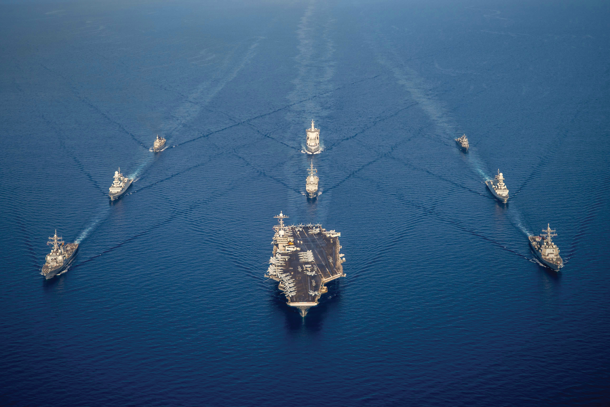
Implications and CountermeasuresThere is great danger when the warships of rival nations come into proximity to one another. When operators can deliberately alter SIGINT and navigation signals to skew the truth—or the perception of the truth—the space is even more dangerous; intentional disruptions to these systems are provocative and have far-reaching consequences. Disrupting GPS and other GNSS creates navigational uncertainty, delays, and inefficiency in the supply chain. The disruptions can also cause accidents in littoral and near-coastal waters, narrow straits, and international chokepoints where ships operate with a small margin for error. False AIS tracks can support virulent narratives, countering the interests of U.S. allies and partners. Moreover, adversaries can spoof AIS to masquerade as a much larger force or change a ship’s navigation history. While cyber attacks have not yet invoked a collective defense response or triggered Article 5 of the NATO treaty, the second- and third-order effects of these disturbances are incalculable. Moreover, during each incident the U.S. Navy must quickly recognize the threats, orient its decisionmaking, and decide a response.
Given the ease of spoofing GPS and AIS signals, we are in a particularly dangerous environment. Any adversary government—whether China, Iran, North Korea, Russia, or others—could easily enter entirely fake tracks of vessel movements into the historical record, in real time. Although some might debate whether attacks on GPS and AIS are in their nature, those arguments miss the point. The term is a misnomer; what we must focus on is protecting the confidentiality, integrity, availability, authenticity, utility, and possession of information and other necessary data. From that perspective, attacks on GPS and AIS clearly affect multiple characteristics of navigational and situational awareness information.
Maritime cybersecurity is particularly pertinent today given Russia’s invasion of Ukraine. Ostensibly, one of Russia’s pretexts for the war is the encroachment of NATO on Russia’s borders. Part of the demonstration of Alliance aggression could well be the spoofing of NATO vessels in June 2021. There is also significant evidence that Russia is using attacks on GPS in the war against Ukraine, targeting aerial, artillery, and other military systems, as well as communications systems (many of which rely on GNSS for timing). Reportedly, Russian jamming has at times been so intense that it has interfered with Russia’s own systems. When it comes to navigation, Russia has access to the Chayka terrestrial electronic navigation system as a backup to GLONASS and other GNSS.